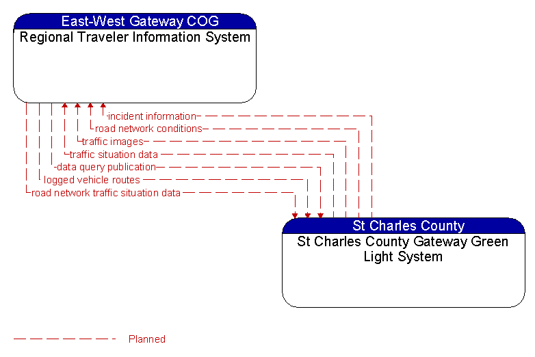
Interface: Regional Traveler Information System - St Charles County Gateway Green Light System
Architecture Flow Definitions
data query publication (Planned) Applicable ITS Standards
Data query publication includes those dialogs necessary to satisfy the response portion of a query–response action using the data distribution architecture. The information content varies widely based on available content and the query, but it generally includes information on the state of transportation system operations including traffic and road conditions, advisories, incidents, transit service information, weather information, parking information, and other related data.
incident information (Planned)
Notification of existence of incident and expected severity, location, time and nature of incident. As additional information is gathered and the incident evolves, updated incident information is provided. Incidents include any event that impacts transportation system operation ranging from routine incidents (e.g., disabled vehicle at the side of the road) through large–scale natural or human–caused disasters that involve loss of life, injuries, extensive property damage, and multi–jurisdictional response. This also includes special events, closures, and other planned events that may impact the transportation system.
logged vehicle routes (Planned) Applicable ITS Standards
Anticipated route information for guided vehicles, special vehicles (e.g., oversize vehicles) or groups of vehicles (e.g., governor's motorcade) that may require changes in traffic control strategy.
road network conditions (Planned) Applicable ITS Standards
Current and forecasted traffic information, road and weather conditions, and other road network status. Either raw data, processed data, or some combination of both may be provided by this flow. Information on diversions and alternate routes, closures, and special traffic restrictions (lane/shoulder use, weight restrictions, width restrictions, HOV requirements) in effect is included.
road network traffic situation data (Planned) Applicable ITS Standards
Aggregated route usage, travel times, and other aggregated data collected from probe vehicles that can be used to estimate current traffic conditions.
traffic images (Planned) Applicable ITS Standards
High fidelity, real–time traffic images suitable for surveillance monitoring by the operator or for use in machine vision applications. This flow includes the images and meta data that describes the images.
traffic situation data (Planned)
Current, aggregate traffic data collected from connected vehicles that can be used to supplement or replace information collected by roadside traffic detectors. It includes raw and/or processed reported vehicle speeds, counts, and other derived measures. Raw and/or filtered vehicle control events may also be included to support incident detection.