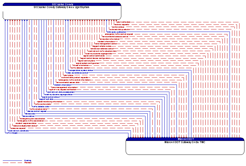
Interface: St Charles County Gateway Green Light System - Missouri DOT Gateway Guide TMC
Architecture Flow Definitions
alert notification (Planned) Applicable ITS Standards
Notification of a major emergency such as a natural or man–made disaster, civil emergency, or child abduction for distribution to the public. The flow identifies the alert originator, the nature of the emergency, the geographic area affected by the emergency, the effective time period, and information and instructions necessary for the public to respond to the alert. This flow may also identify specific information that should not be released to the public.
alert status (Planned) Applicable ITS Standards
Information indicating the current status of the emergency alert including identification of the traveler and driver information systems that are being used to provide the alert.
archive requests (Planned) Applicable ITS Standards
A request to a data source for information on available data (i.e., "catalog") or a request that defines the data to be archived. The request can be a general subscription intended to initiate a continuous or regular data stream or a specific request intended to initiate a one–time response from the recipient.
archive status (Planned) Applicable ITS Standards
Notification that data provided to an archive contains erroneous, missing, or suspicious data or verification that the data provided appears valid. If an error has been detected, the offending data and the nature of the potential problem are identified.
archived data product requests (Planned) Applicable ITS Standards
A user–specified request for archived data products (i.e., data, meta data, or data catalogs). The request also includes information that is used to identify and authenticate the user and support electronic payment requirements, if any.
archived data products (Planned) Applicable ITS Standards
Raw or processed data, meta data, data catalogs and other data products provided to a user system upon request. The response may also include any associated transaction information.
data query publication (Existing) Applicable ITS Standards
Data query publication includes those dialogs necessary to satisfy the response portion of a query–response action using the data distribution architecture. The information content varies widely based on available content and the query, but it generally includes information on the state of transportation system operations including traffic and road conditions, advisories, incidents, transit service information, weather information, parking information, and other related data.
device control request (Existing) Applicable ITS Standards
Request for device control action
device data (Existing) Applicable ITS Standards
Data from detectors, environmental sensor stations, roadside equipment, and traffic control devices, including device inventory information.
device status (Existing) Applicable ITS Standards
Status information from devices
emergency plan coordination (Planned) Applicable ITS Standards
Information that supports coordination of emergency management plans, continuity of operations plans, emergency response and recovery plans, evacuation plans, and other emergency plans between agencies. This includes general plans that are coordinated prior to an incident and shorter duration tactical plans that are prepared during an incident.
emergency traffic control information (Planned) Applicable ITS Standards
Status of a special traffic control strategy or system activation implemented in response to an emergency traffic control request, a request for emergency access routes, a request for evacuation, a request to activate closure systems, a request to employ driver information systems to support public safety objectives, or other special requests. Identifies the selected traffic control strategy and system control status.
emergency traffic control request (Planned) Applicable ITS Standards
Special request to preempt the current traffic control strategy in effect at one or more signalized intersections or highway segments, activate traffic control and closure systems such as gates and barriers, activate safeguard systems, or use driver information systems. For example, this flow can request all signals to red–flash, request a progression of traffic control preemptions along an emergency vehicle route, request a specific evacuation traffic control plan, request activation of a road closure barrier system, or place a public safety or emergency–related message on a dynamic message sign.
emergency traffic coordination (Planned) Applicable ITS Standards
Coordination supporting disaster response including evacuation and reentry. Includes coordination of special traffic control strategies that support efficient evacuation and reentry while protecting and optimizing movement of response vehicles and other resources responding to the emergency.
environmental sensor data (Planned)
Current road conditions (e.g., surface temperature, subsurface temperature, moisture, icing, treatment status) and surface weather conditions (e.g., air temperature, wind speed, precipitation, visibility) as measured and reported by fixed and/or mobile environmental sensors. Operational status of the sensors is also included.
environmental sensors control (Planned)
Data used to configure and control environmental sensors.
evacuation information (Planned) Applicable ITS Standards
Evacuation instructions and information including evacuation zones, evacuation times, and reentry times.
incident information (Planned) Applicable ITS Standards
Notification of existence of incident and expected severity, location, time and nature of incident. As additional information is gathered and the incident evolves, updated incident information is provided. Incidents include any event that impacts transportation system operation ranging from routine incidents (e.g., disabled vehicle at the side of the road) through large–scale natural or human–caused disasters that involve loss of life, injuries, extensive property damage, and multi–jurisdictional response. This also includes special events, closures, and other planned events that may impact the transportation system.
incident response status (Planned) Applicable ITS Standards
Status of the current incident response including a summary of incident status and its impact on the transportation system, traffic management strategies implemented at the site (e.g., closures, diversions, traffic signal control overrides), and current and planned response activities.
lane management control (Planned)
Information used to configure and control dynamic lane management systems.
lane management information (Planned)
System status of managed lanes including current operational state, violations, and logged information. This includes lane usage information including both traditional traffic flow measures and special information associated with managed lanes such as measured passenger occupancies. It also includes the operational status of the lane management equipment.
logged vehicle routes (Planned) Applicable ITS Standards
Anticipated route information for guided vehicles, special vehicles (e.g., oversize vehicles) or groups of vehicles (e.g., governor's motorcade) that may require changes in traffic control strategy.
remote surveillance control (Planned) Applicable ITS Standards
The control commands used to remotely operate another center's sensors or surveillance equipment so that roadside surveillance assets can be shared by more than one agency.
resource deployment status (Planned) Applicable ITS Standards
Status of resource deployment identifying the resources (vehicles, equipment, materials, and personnel) available and their current status. General resource inventory information and specific status of deployed resources may be included.
resource request (Planned) Applicable ITS Standards
A request for resources to implement special traffic control measures, assist in clean up, verify an incident, etc. The request may poll for resource availability or request pre–staging, staging, or immediate deployment of resources. Resources may be explicitly requested or a service may be requested and the specific resource deployment may be determined by the responding agency.
right-of-way request notification (Planned)
Notice that a request has occurred for signal prioritization, signal preemption, pedestrian call, multi–modal crossing activation, or other source for right–of–way.
road network conditions (Existing) Applicable ITS Standards
Current and forecasted traffic information, road and weather conditions, and other road network status. Either raw data, processed data, or some combination of both may be provided by this flow. Information on diversions and alternate routes, closures, and special traffic restrictions (lane/shoulder use, weight restrictions, width restrictions, HOV requirements) in effect is included.
road network status assessment (Existing) Applicable ITS Standards
Assessment of damage sustained by the road network including location and extent of the damage, estimate of remaining capacity, required closures, alternate routes, necessary restrictions, and time frame for repair and recovery.
road network traffic situation data (Planned) Applicable ITS Standards
Aggregated route usage, travel times, and other aggregated data collected from probe vehicles that can be used to estimate current traffic conditions.
roadway dynamic signage data (Planned)
Information used to initialize, configure, and control dynamic message signs. This flow can provide message content and delivery attributes, local message store maintenance requests, control mode commands, status queries, and all other commands and associated parameters that support remote management of these systems.
roadway dynamic signage status (Existing)
Current operating status of dynamic message signs, highway advisory radios, or other configurable field equipment that provides dynamic information to the driver.
signal control commands (Planned)
Control of traffic signal controllers or field masters including clock synchronization.
signal control device configuration (Planned)
Data used to configure traffic signal control equipment including local controllers and system masters.
signal control plans (Planned)
Traffic signal timing parameters including minimum green time and interval durations for basic operation and cycle length, splits, offset, phase sequence, etc. for coordinated systems.
signal control status (Existing)
Operational and status data of traffic signal control equipment including operating condition and current indications.
signal fault data (Existing)
Faults reported by traffic signal control equipment.
signal system configuration (Planned)
Data used to configure traffic signal systems including configuring control sections and mode of operation (time based or traffic responsive).
speed monitoring information (Planned)
System status including current operational state and logged information including measured speeds, warning messages displayed, and violation records.
threat information (Planned) Applicable ITS Standards
Threats regarding transportation infrastructure, facilities, or systems detected by a variety of methods (sensors, surveillance, threat analysis of advisories from outside agencies, etc.
traffic archive data (Planned) Applicable ITS Standards
Information describing the use and vehicle composition on transportation facilities and the traffic control strategies employed. Content may include a catalog of available information, the actual information to be archived, and associated meta data that describes the archived information.
traffic detector control (Planned)
Information used to configure and control traffic detector systems such as inductive loop detectors and machine vision sensors.
traffic detector data (Existing)
Raw and/or processed traffic detector data which allows derivation of traffic flow variables (e.g., speed, volume, and density measures) and associated information (e.g., congestion, potential incidents). This flow includes the traffic data and the operational status of the traffic sensor system.
traffic images (Existing) Applicable ITS Standards
High fidelity, real–time traffic images suitable for surveillance monitoring by the operator or for use in machine vision applications. This flow includes the images and meta data that describes the images.
traffic situation data (Planned)
Current, aggregate traffic data collected from connected vehicles that can be used to supplement or replace information collected by roadside traffic detectors. It includes raw and/or processed reported vehicle speeds, counts, and other derived measures. Raw and/or filtered vehicle control events may also be included to support incident detection.
transportation system status (Existing) Applicable ITS Standards
Current status and condition of transportation infrastructure (e.g., tunnels, bridges, interchanges, TMC offices, maintenance facilities). In case of disaster or major incident, this flow provides an assessment of damage sustained by the surface transportation system including location and extent of the damage, estimate of remaining capacity and necessary restrictions, and time frame for repair and recovery.
video surveillance control (Existing)
Information used to configure and control video surveillance systems.